Langbiang Mountain Dalat: Jeep, Trekking & Tickets
Langbiang Mountain (Núi Lang Biang) is the “roof of Da Lat”: a twin-peaked mountain about 12 km north of the city whose highest summit reaches about 2,167 m. It lies within the UNESCO Langbiang Biosphere Reserve (2015) and is named after the legend of K’Lang and H’Biang. Most visitors take a jeep to Radar Hill; entry is 50,000 VND.
Status (checked October 2026): the Langbiang tourist area is open daily (entry 50,000 VND adults, jeep to Radar Hill 120,000 VND per person). The self-guided forest trail to the 2,167 m summit was suspended by Bidoup–Nui Ba National Park in October 2024 for safety; we have found no public reopening notice, so trek only with a licensed local operator.
Why Langbiang Mountain is worth seeing:
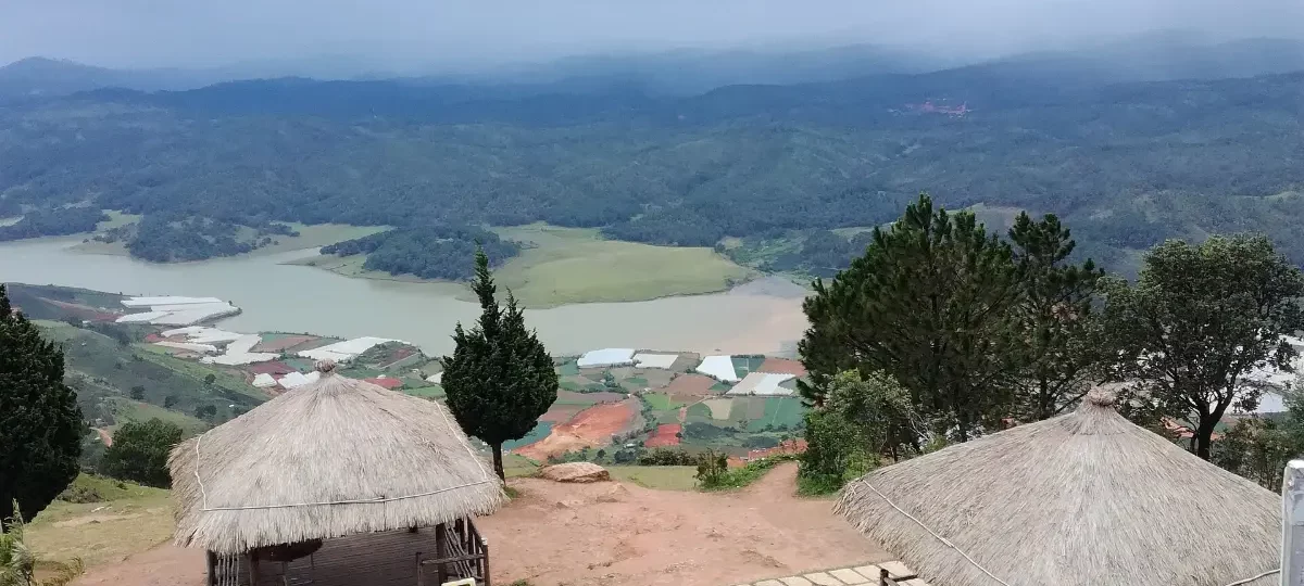
- Panoramic views: from Radar Hill you see Da Lat, Lac Duong valley, Golden Stream (Suối Vàng) lake and the pine-clad plateau.
- A love legend: the mountain carries the names of the young lovers K’Lang and H’Biang.
- UNESCO biosphere reserve: part of the Langbiang Biosphere Reserve, centred on Bidoup–Nui Ba National Park.
- Jeep ride or hike: an easy jeep trip for everyone, or a demanding guided trek for fit walkers.
- Highland culture: the foothills are home to K’Ho communities, including the Lạch and Chil groups.
Langbiang Mountain at a Glance
| Vietnamese name | Núi Lang Biang (Núi Bà – “Lady Peak”, Núi Ông – “Gentleman Peak”) |
|---|---|
| Location | Langbiang tourist area, Langbiang Road, Lang Biang – Da Lat Ward (formerly Lac Duong town), Lam Dong province |
| Distance | About 12 km north of central Da Lat (25–30 minutes by car) |
| Height | Highest summit about 2,167 m; Radar Hill viewpoint about 1,950 m |
| Known for | Jeep ride to Radar Hill, summit trekking, legend of K’Lang and H’Biang |
| Recognition | Within the UNESCO Langbiang Biosphere Reserve (designated 2015) |
| Opening hours | Daily, 7:30–17:00 |
| Entrance fee | 50,000 VND adults, 25,000 VND children; jeep about 120,000 VND per person (shared) |
| Time needed | 2–3 hours with the jeep; 5–7 hours for a guided summit trek |
| Best time | December–March, morning for clear views |
| Nearby | Valley of Love, Lat village, Golden Stream lake, Bidoup–Nui Ba National Park |
| Find it | Google Maps · Tripadvisor · Wikipedia (Lang Biang Plateau) |
Is Langbiang Mountain Worth Visiting?
Yes, if the weather is clear. The jeep ride to Radar Hill is quick and the view over the Lang Biang Plateau is the widest you will get near Da Lat. On cloudy days, though, the top can be wrapped in fog, so check the forecast and go in the morning. Keen hikers should know that summit treks are now only advisable with a licensed guide.
- Best for: view lovers, families (by jeep), active travellers and hikers with a guide.
- Skip if: the forecast is for low cloud, or you dislike busy viewpoints with cafés and photo props.
- Short on time: jeep up to Radar Hill, 45 minutes at the top, jeep down, and stop at the Valley of Love on the way back.
The Legend of K’Lang and H’Biang
Local K’Ho tradition tells of K’Lang, son of a Lạch chief, and H’Biang, daughter of a Chil chief. Their families forbade the marriage, and the lovers died together on the mountain. The two peaks are said to be their resting places: the higher Lady Peak (Núi Bà) for H’Biang and Gentleman Peak (Núi Ông) for K’Lang. Their joined names, Lang Biang, became the name of the mountain and the whole plateau around Da Lat. A statue of the couple stands in the tourist area at the foot of the mountain.
Background: Langbiang Plateau and the Biosphere Reserve
The Lang Biang (Lâm Viên) Plateau is the highland at the southern end of the Annamite Range on which Da Lat stands. In 2015 UNESCO designated the Langbiang Biosphere Reserve, centred on Bidoup–Nui Ba National Park, which protects montane pine and broadleaf forests, rare orchids and endemic birds. Langbiang Mountain lies within the area managed by the national park. In the 2025 administrative reform, Lac Duong town, Lat commune and Da Lat’s old Ward 7 were merged into the new Lang Biang – Da Lat Ward of Lam Dong province.
What to See at Langbiang Mountain
1. Radar Hill viewpoint
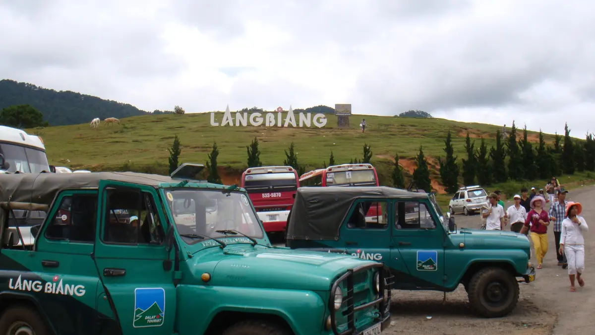
Radar Hill (Đồi Rada), at about 1,950 m, is reached by the tourist area’s jeeps on a winding road of about 6 km. It has viewing platforms, cafés and photo spots looking south over Da Lat and Lac Duong valley.
2. Lady Peak (Núi Bà) summit
The highest point, about 2,167 m, is reached only on foot through forest. The round trip is roughly 8–9 km with a steep final section and takes about 3.5–5 hours of walking. Since late 2024 the national park has banned unregistered independent trekking; book a licensed guide.
3. The K’Lang and H’Biang statue and foothill park
At the base, the tourist area has gardens, the lovers’ statue and the jeep station. It is a pleasant stop even if you do not go up.
4. Golden Stream lake (Suối Vàng) views
From the slopes you can see the Dankia–Suoi Vang reservoir system to the west, especially beautiful in the late afternoon.
5. K’Ho culture in Lat village
Lat village at the foot of the mountain is home to K’Ho communities. Some evenings, gong and campfire performances of Central Highlands gong culture are offered to groups.
Langbiang Mountain Tickets and Opening Hours (2026)
| Item | Price | Notes |
|---|---|---|
| Entry ticket, adult | 50,000 VND (about 2 USD) | Langbiang tourist area gate |
| Entry ticket, child | 25,000 VND | Children under about 1.2 m |
| Jeep to Radar Hill, shared | 120,000 VND per person (adult or child) | Return trip; departs when 6 seats are filled |
| Jeep, whole vehicle | Equivalent of 6 seats (about 720,000 VND) | No waiting |
| Opening hours | 7:30–17:00 daily | Jeeps leave when 6 passengers are ready, or charter the whole jeep |
Prices are set by the operator, Lam Dong Tourism JSC (Dalattourist); check the official Dalattourist website for current fares.
How to Visit Langbiang Mountain, Step by Step
- Leave Da Lat by 7:30–8:00 for clearer skies.
- Buy the entry ticket at the tourist area gate and a jeep ticket at the jeep station.
- Ride to Radar Hill (about 15 minutes) and enjoy the viewpoints; keep your jeep ticket for the return.
- If trekking, meet your licensed guide at the gate and register as required by the park.
- On the way back, stop at the Valley of Love or a highland coffee farm.
How to Get to Langbiang Mountain
| From | How | Time |
|---|---|---|
| Central Da Lat | Taxi or Grab via Langbiang Road | About 25–30 minutes |
| Central Da Lat | Rented motorbike | About 25 minutes |
| Central Da Lat | Local bus towards Lac Duong (ask your hotel for the current stop) | About 40 minutes |
| Valley of Love | Taxi | About 15 minutes |
| Lien Khuong Airport | Taxi or private car | About 1 hour |
See our Dalat transportation guide for taxis and motorbike rental.
Best Time to Visit Langbiang Mountain
| When | What to expect |
|---|---|
| December–March | Dry, clear views; best season for jeep and trekking |
| April–May | Warmer, occasional showers; still good in the morning |
| June–November | Rainy season; fog, slippery trails, landslide risk |
| Morning (7:30–10:00) | Clearest views before clouds build |
| Late afternoon | Soft light over Golden Stream lake; colder and windy |
Local Expert Tips for Langbiang Mountain
These tips come from years of arranging Da Lat tours for international travellers.
- Bring a warm layer and windproof jacket; the summit area is several degrees colder than the city.
- Pay for a private jeep if you do not want to wait for seats to fill.
- Never trek alone; people have been lost overnight on Langbiang’s forest trails.
- Wear shoes with good grip and carry 1.5–2 litres of water for a guided trek.
- Combine with coffee farms and the Valley of Love for a half-day trip north.
- Read our Dalat travel tips for packing and weather advice.
Langbiang Mountain vs Bidoup–Nui Ba National Park
| Langbiang Mountain | Bidoup–Nui Ba National Park | |
|---|---|---|
| Distance from Da Lat | About 12 km | About 50 km (park headquarters) |
| Experience | Viewpoint by jeep, guided summit trek | Wild forest trails, birdwatching, multi-day treks |
| Facilities | Tourist area with cafés and jeeps | Basic; visitor centre and ranger stations |
| Time needed | 2–3 hours | Full day or longer |
| Best for | Most visitors | Serious hikers and nature lovers |
Our view: Langbiang is the easy, rewarding choice for most travellers; choose a guided Bidoup–Nui Ba trek only if wilderness is your priority.
Nearby Attractions
- Valley of Love: gardens and lake on the way back to town.
- Xuan Huong Lake: the heart of Da Lat, about 12 km south.
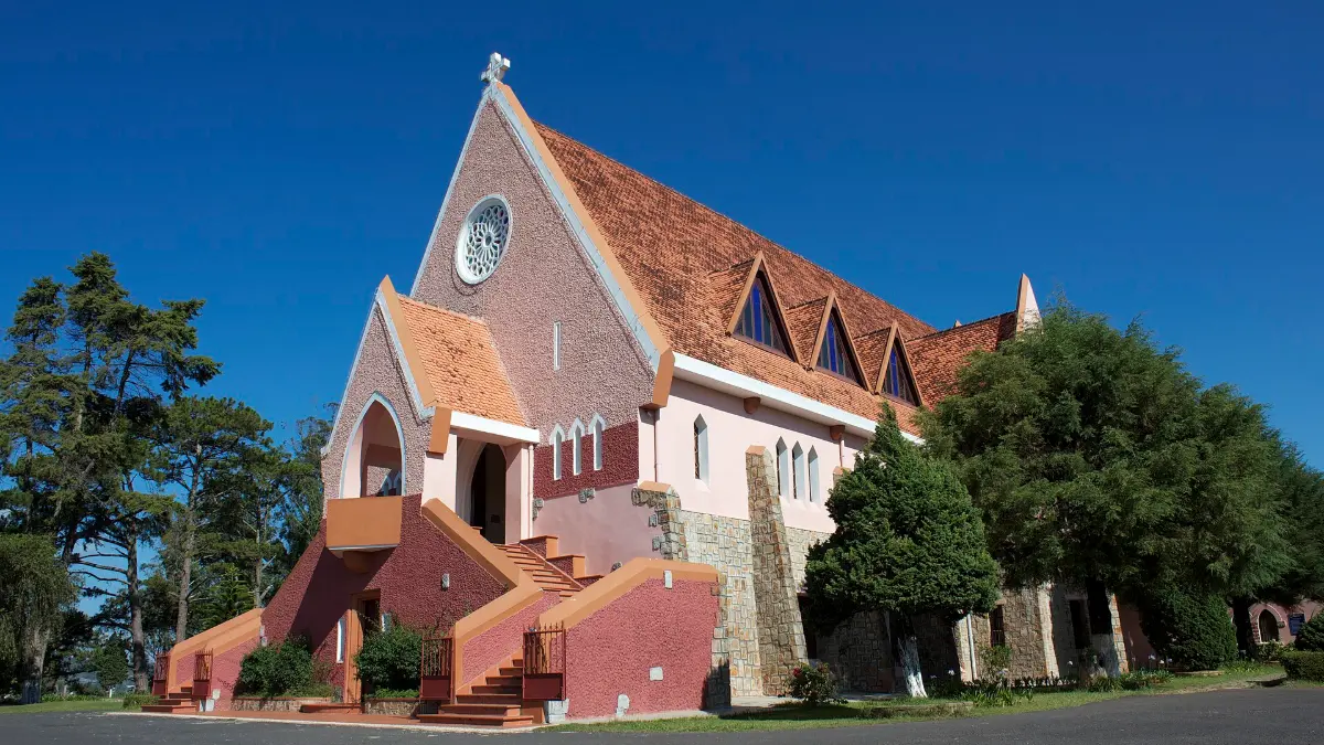
- Domaine de Marie Church: Da Lat’s pink church.
- Tuyen Lam Lake: forest lake south of the city.
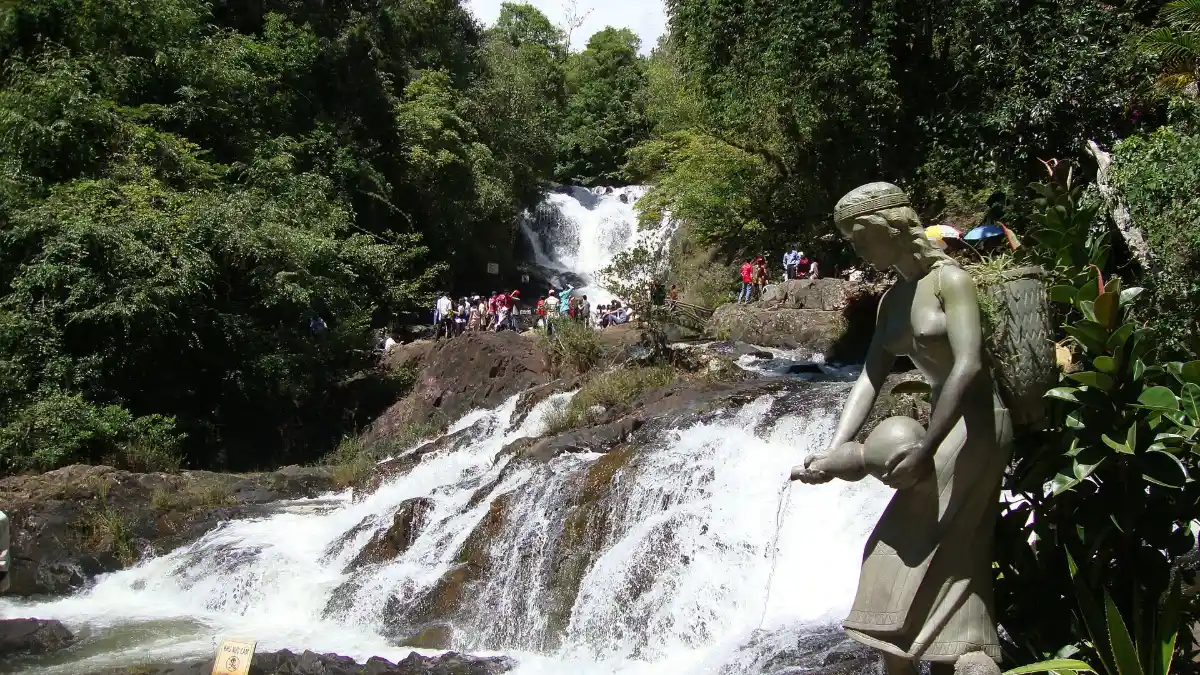
- Datanla Waterfall: alpine coaster and canyoning.
Sightseeing in Da Lat for First-Time Visitors: Where Langbiang Mountain Fits
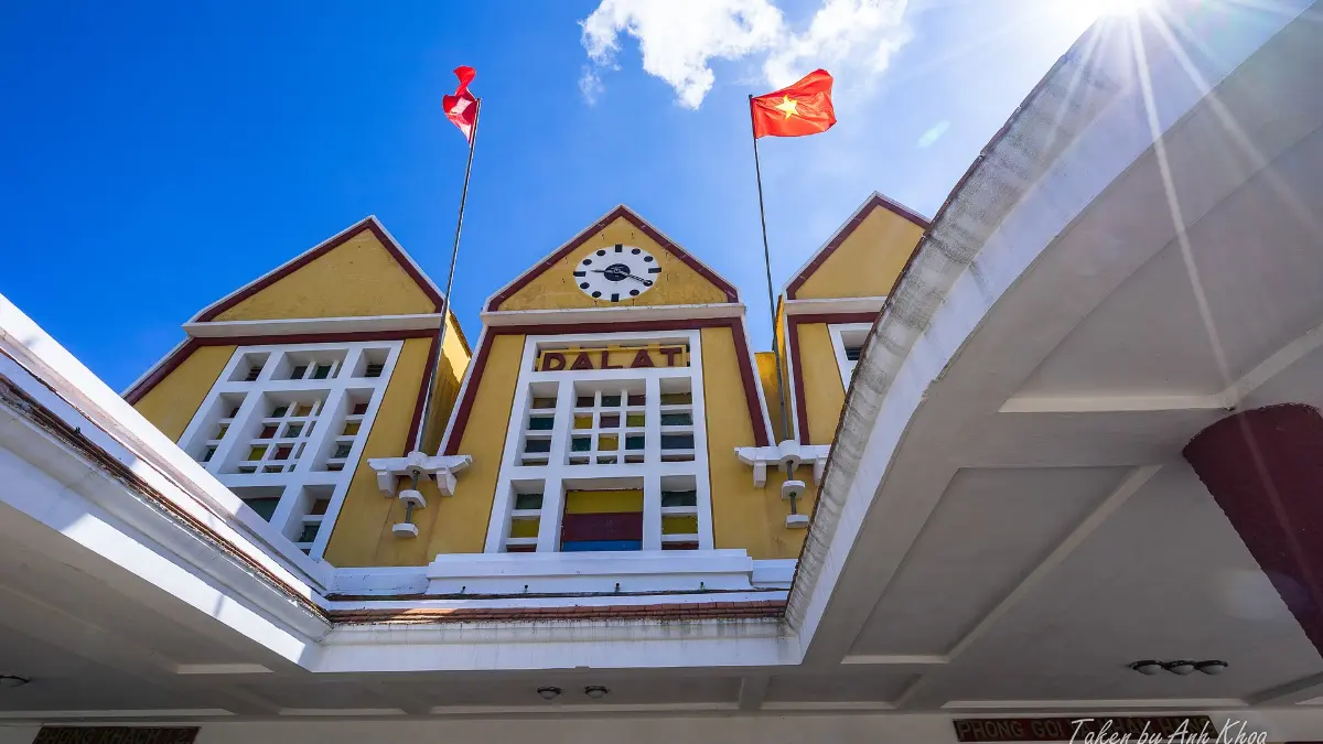
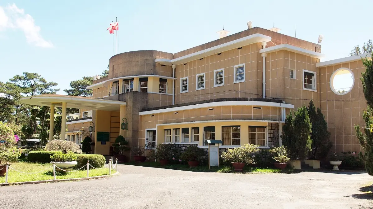
Langbiang works best as a morning trip north of the city, paired with the Valley of Love and a coffee farm, leaving the afternoon for Bao Dai Palace or the railway station. Choose a central base using our Dalat accommodation guide.
Plan your trip with our Da Lat travel guide and Da Lat tours. Contact Vietnam Tour Expert Team for a free custom itinerary.
Frequently Asked Questions about Langbiang Mountain
1. Where is Langbiang Mountain?
Langbiang Mountain is about 12 km north of central Da Lat, in Lang Biang – Da Lat Ward (formerly Lac Duong town), Lam Dong province.
2. How high is Langbiang Mountain?
The highest summit of Langbiang Mountain is about 2,167 m; Radar Hill, the jeep viewpoint, is about 1,950 m.
3. How much is the Langbiang Mountain entrance fee?
Entry to the Langbiang Mountain tourist area costs 50,000 VND for adults and 25,000 VND for children.
4. How much is the jeep to the top of Langbiang Mountain?
A shared jeep to Radar Hill on Langbiang Mountain costs 120,000 VND per person return; jeeps leave when six seats are filled, or you can pay for the whole jeep.
5. Can you hike Langbiang Mountain?
Yes, but since October 2024 the national park has suspended independent trekking to the Langbiang Mountain summit for safety, so go with a licensed guide.
6. How long does it take to climb Langbiang Mountain?
A guided round trip to the Langbiang Mountain summit takes about 3.5–5 hours of walking (roughly 8–9 km).
7. What is the legend of Langbiang Mountain?
Langbiang Mountain is named after K’Lang and H’Biang, young lovers from rival K’Ho groups who died together; the two peaks are said to be their graves.
8. Is Langbiang Mountain a UNESCO site?
Langbiang Mountain lies within the Langbiang Biosphere Reserve, designated by UNESCO’s Man and the Biosphere Programme in 2015.
9. What is the best time to visit Langbiang Mountain?
Visit Langbiang Mountain between December and March, in the morning, for the clearest views.
10. How do I get to Langbiang Mountain from Da Lat?
Take a taxi, Grab or motorbike to Langbiang Mountain, about 25–30 minutes north of Da Lat via Langbiang Road.
11. What are the opening hours of Langbiang Mountain?
The Langbiang Mountain tourist area opens daily from 7:30 to 17:00.
12. Is Langbiang Mountain cold?
Yes, Langbiang Mountain is noticeably colder and windier than Da Lat, so bring a warm jacket.
13. Is Langbiang Mountain suitable for children?
Yes, by jeep; children enjoy Radar Hill on Langbiang Mountain, but the summit trek is too demanding for young kids.
14. How long should I spend at Langbiang Mountain?
Allow 2–3 hours at Langbiang Mountain by jeep, or most of a day for a guided trek.
15. What can you see from Langbiang Mountain?
From Langbiang Mountain you see Da Lat, Lac Duong valley, Golden Stream lake and the pine forests of the plateau.
16. Is Langbiang Mountain worth it on a cloudy day?
On low-cloud days the view from Langbiang Mountain can disappear completely; go another morning if you can.
17. Can I combine Langbiang Mountain with other sights?
Yes, Langbiang Mountain pairs well with the Valley of Love and coffee farms on the same road.
18. Which ethnic groups live around Langbiang Mountain?
The foothills of Langbiang Mountain are home to K’Ho communities, including the Lạch and Chil groups.
Related Posts
Dalat Travel Tips 2026: Weather, Best Time & Itinerary
Where to Stay in Dalat: Best Areas, Villas & Resorts
Dalat Transportation: Flights, Buses & Getting Around

Dalat Food Guide: Banh Trang Nuong, Hotpot & Coffee
Tuyen Lam Lake Dalat: Kayaking, Boats & Lakeside Resorts