Vietnam Distance Chart 2026: Travel Times Between Top Destinations
 By Jimmy Nguyen, Founder & Director of Asia Travel Expert Co., Ltd.
Vietnam is about 1,650 km long from north to south. Most classic hops are short: Hanoi to Ninh Binh is about 90–100 km (1.5–2 hours by car), Hanoi to Ha Long Bay about 150–170 km (2.5–3 hours) and Da Nang to Hoi An about 30 km (40–50 minutes). The long legs are a different matter. Hanoi to Ho Chi Minh City is about 1,500–1,700 km by road and 1,726 km by rail, so most travellers fly it in about 2 hours 10 minutes.
Status (checked November 2026):
- Distances are road distances from town centre to town centre, cross-checked with Google Maps and OpenStreetMap routing.
- Drive times are realistic private-car times with one short stop, not traffic-free estimates.
- Train times follow the 2026 Vietnam Railways timetable.
- Flight times are scheduled non-stop times.
New expressway sections keep opening, so several road times are getting shorter each year.
Quick answers – the distances travellers ask about most:
- Hanoi to Ninh Binh: 90–100 km. About 1.5–2 h by car, about 2 h 15 min by train.
- Hanoi to Ha Long Bay: 150–170 km. About 2.5–3 h on the expressway.
- Hanoi to Sa Pa: 315–320 km.
- Car: about 5–5.5 h.
- Bus: 5.5–6.5 h.
- Night train to Lao Cai: about 8 h, plus about 50 min by road.
- Hanoi to Ha Giang: 285–300 km. About 5.5–6.5 h by car, 6.5–8 h by sleeper bus.
- Hanoi to Hue: about 650–670 km by road.
- Flight: about 1 h 15 min.
- Train: 12.5–14 h.
- Hue to Hoi An: 120–130 km.
- Through the Hai Van Tunnel: 2.5–3 h.
- Over the Hai Van Pass with stops: 3.5–4.5 h.
- Da Nang to Hoi An: about 30 km, 40–50 min.
- Ho Chi Minh City to the Mekong Delta:
- My Tho: about 70 km, 1.5–2 h.
- Can Tho: about 170 km, 3.5–4 h.
- Ho Chi Minh City to Da Lat: about 300 km.
- Road: 6–8 h.
- Flight: 50 min–1 h.
- Hanoi to Ho Chi Minh City:
- Flight: 2 h 10–2 h 15 min.
- Fastest train: 32.5–35 h.
Vietnam Distances at a Glance
| Length of Vietnam | About 1,650 km north to south. The country is only about 50 km wide at its narrowest point, near Dong Hoi in the former Quang Binh province (now part of Quang Tri). |
|---|---|
| Hanoi – Ho Chi Minh City |
|
| Typical road speed |
|
| Longest common drives |
|
| Main airports | Hanoi (HAN), Ho Chi Minh City (SGN), Da Nang (DAD), Hue (HUI), Nha Trang–Cam Ranh (CXR), Da Lat (DLI), Phu Quoc (PQC), Dong Hoi (VDH), Quy Nhon (UIH) |
| Railway | The Reunification Express runs Hanoi – Ninh Binh – Dong Hoi – Hue – Da Nang – Quy Nhon (Dieu Tri) – Nha Trang – Ho Chi Minh City. There is also a line from Hanoi to Lao Cai for Sa Pa. |
| No railway | Ha Long Bay, Ha Giang, Hoi An, Da Lat, Mui Ne town, Can Tho, Phu Quoc |
| Planning rule | Keep road legs under 4–5 hours a day. Fly any leg over about 600 km. |
How to Read These Distances and Travel Times
Distances are measured by road between the places travellers actually use. For example:
- Hanoi means the Old Quarter.
- Ninh Binh means Tam Coc or Trang An.
- Ha Long means Bai Chay or Tuan Chau, where the cruises leave from.
- Ho Chi Minh City means District 1.
Because of this, a figure can differ by 5–15 km from the straight administrative distance quoted elsewhere.
Drive times assume a private car or a private transfer with a driver, plus one short rest stop. Adjust them as follows:
- Limousine van with hotel pick-ups: add 30–60 minutes.
- Sleeper bus: add 1–2 hours.
- Friday afternoons, weekends, public holidays and the days around Tet: add 20–30%.
- Mountain roads in the rainy season: add 20–30%. That season is May to September in the north and September to December in central Vietnam.
A one-hour flight is not one hour door to door. Getting to the airport, checking in, flying and transferring into town usually takes 4–5 hours in total. That is why a 3-hour drive is often the better choice for anything under about 250 km.
Northern Vietnam Distances: Hanoi, Ninh Binh, Ha Long Bay, Sa Pa and Ha Giang
Hanoi is the hub for the north, and almost every route starts or ends there. Expressways now link Hanoi with Ninh Binh, Ha Long, Hai Phong and Lao Cai, so these legs are fast. The slow sections are the last mountain kilometres to Ha Giang’s Dong Van plateau, Cao Bang and Pu Luong.
| Route | Distance | By car | Other options |
|---|---|---|---|
| Hanoi – Ninh Binh (Tam Coc / Trang An) | 90–100 km | 1.5–2 h | Train about 2 h 15 min; limousine van 2–2.5 h |
| Noi Bai Airport – Hanoi Old Quarter | 26–30 km | 35–60 min | Airport bus 86, about 45–60 min |
| Noi Bai Airport – Ninh Binh | 120–130 km | 2–2.5 h | Private transfer straight from arrivals |
| Hanoi – Ha Long Bay (Bai Chay / Tuan Chau) | 150–170 km | 2.5–3 h | Cruise shuttle or limousine van 2.5–3.5 h |
| Hanoi – Hai Phong (Lan Ha Bay cruises) | about 105–110 km | 1.5–2 h | Limousine van about 2 h |
| Hanoi – Cat Ba Island | about 150 km including ferry | 3.5–4.5 h with the ferry | Bus and ferry combo ticket 4–5.5 h |
| Ninh Binh – Ha Long Bay | 170–175 km | 2.5–3 h | Daily shuttle buses; no need to go back to Hanoi |
| Hanoi – Sa Pa | 315–320 km | 5–5.5 h |
|
| Lao Cai Station – Sa Pa | 33–35 km | 45 min–1 h | Shuttle bus meets the morning trains |
| Hanoi – Ha Giang City | 285–300 km | 5.5–6.5 h | Sleeper bus 6.5–8 h |
| Ha Giang City – Dong Van | about 145 km | 3.5–4.5 h | Mountain road via Quan Ba and Yen Minh |
| Dong Van – Meo Vac (Ma Pi Leng Pass) | about 20–25 km | 45 min–1 h with photo stops | Most scenic stretch of the Ha Giang Loop |
| Ha Giang Loop (full circuit) | about 350 km | 3–4 days | Jeep, car with driver or motorbike with an easy rider |
| Sa Pa – Ha Giang City | 230–240 km | 5–6 h | Daily sleeper and limousine buses |
| Hanoi – Cao Bang City | 270–285 km | 5.5–6 h | Sleeper bus 6–7 h |
| Hanoi – Ban Gioc Waterfall | 310–335 km | 6.5–7 h | Usually done as a 2–3 day trip |
| Cao Bang City – Ban Gioc Waterfall | 85–90 km | 1.5–2 h | Mountain road |
| Ha Giang City – Cao Bang City | about 230 km | 6–7 h | Slow mountain road; few public buses |
| Hanoi – Mai Chau | 135–140 km | 3–3.5 h | Limousine van about 3.5–4 h |
| Hanoi – Pu Luong | 175–185 km | 3.5–4 h | Limousine van 4–4.5 h |
| Mai Chau – Pu Luong | about 50 km | about 1.5 h | Winding road through the valleys |
| Ninh Binh – Pu Luong | about 135 km | about 3 h | Private car |
| Hanoi – Duong Lam Ancient Village | 45–55 km | 1–1.5 h | Half-day trip |
| Hanoi – Perfume Pagoda (Ben Duc wharf) | about 60 km | about 1.5 h | Then about 1 h by rowing boat |
| Ha Long Bay – Sa Pa | 460–485 km | 6.5–7.5 h | Expressway via Hanoi; direct sleeper buses run |
For full guides with fares and timetables, read:
- Hanoi to Ninh Binh
- Hanoi to Ha Long Bay
- Hanoi to Sa Pa
- Hanoi to Ha Giang
- Ninh Binh to Ha Long Bay
- Cat Ba Island
- Sapa to Ha Giang
- Hanoi to Cat Ba & Lan Ha Bay
Short on time? Ninh Binh and Ha Long both work as day trips from Hanoi. See our Hoa Lu – Tam Coc day tour and Ha Long Bay day tour.
Central Vietnam Distances: Phong Nha, Hue, Da Nang, Hoi An and Quy Nhon
Central Vietnam is compact around Hue, Da Nang and Hoi An: none of them is more than about 2.5 hours from the others. The long gaps are northwards to Phong Nha and Hanoi, and southwards to Quy Nhon and Nha Trang. On these, a flight or an overnight train usually beats the road.
| Route | Distance | By car | Other options |
|---|---|---|---|
| Hanoi – Phong Nha | 470–485 km | 7–8 h |
|
| Ninh Binh – Phong Nha | 380–390 km | 5.5–6.5 h | Train Ninh Binh – Dong Hoi 7.5–8.5 h |
| Dong Hoi – Phong Nha | 40–45 km | 45 min–1 h | Local bus or transfer from Dong Hoi station or airport |
| Phong Nha – Hue | about 210 km | 3.5–4 h | Daily tourist buses about 4–5 h |
| Dong Hoi – Hue | about 180 km | 3–3.5 h | Train about 3–3.5 h |
| Hanoi – Hue | 650–670 km | 9.5–11 h |
|
| Phu Bai Airport – Hue city | about 15 km | 20–30 min | Airport bus or Grab |
| Hue – Da Nang | 95–100 km | 1 h 45 min–2 h 15 min (Hai Van Tunnel) | Train 2.5–3 h along the coast |
| Hue – Hoi An | 120–130 km | 2.5–3 h by tunnel; 3.5–4.5 h over the Hai Van Pass with stops | Private car is best; no railway to Hoi An |
| Da Nang – Hoi An | about 30 km | 40–50 min | Grab, taxi, shuttle bus |
| Da Nang Airport – Hoi An | about 30 km | 40–45 min | Private transfer or Grab |
| Da Nang – Ba Na Hills (cable car station) | 30–35 km | 40–50 min | Shuttle buses from the city |
| Hoi An – My Son Sanctuary | about 40 km | about 1 h | Also by boat on the Thu Bon River on some tours |
| Da Nang – Quy Nhon | about 310 km | 5–6 h | Train Da Nang – Dieu Tri 5.5–6 h |
| Quy Nhon – Nha Trang | about 215 km | 3.5–4 h | Train Dieu Tri – Nha Trang 4–4.5 h |
| Da Nang – Nha Trang | about 500 km | 8–9 h | Train 9.5–10.5 h |
| Hanoi – Da Nang | about 770 km | 11–13 h |
|

For full guides with fares and timetables, read:
- Hanoi to Hue
- Hanoi to Phong Nha
- Hue to Da Nang
- Da Nang to Hoi An
- Hue to Hoi An via the Hai Van Pass
- Hanoi to Hoi An
- getting around Hoi An
- Hanoi to Da Nang
- Ho Chi Minh City to Da Nang
- Da Nang to Nha Trang
The Hai Van Pass is best done on the road, by car or with our Hoi An to Hue Vespa tour.
Southern Vietnam Distances: Nha Trang, Da Lat, Mui Ne, Ho Chi Minh City and the Mekong Delta
Ho Chi Minh City is the hub for the south. New expressways towards Phan Thiet, Nha Trang and Can Tho have cut several journeys by 1–2 hours since 2023. Da Lat is still reached on mountain passes, so it remains slow by road.
| Route | Distance | By car | Other options |
|---|---|---|---|
| Cam Ranh Airport – Nha Trang | 35–42 km | 40–50 min | Airport bus or Grab |
| Nha Trang – Da Lat | about 135 km | 3–3.5 h (Khanh Le Pass) | Limousine van 3.5–4 h |
| Lien Khuong Airport – Da Lat | about 30 km | 40–50 min | Airport bus or Grab |
| Nha Trang – Mui Ne | about 220 km | 3.5–4 h | Train to Binh Thuan station about 4.5 h, then about 40 min by road |
| Da Lat – Mui Ne | about 150 km | 3.5–4 h | Limousine van about 4 h |
| Ho Chi Minh City – Mui Ne | 190–200 km | 3–3.5 h (expressway) | Train to Binh Thuan about 3.5–4 h |
| Ho Chi Minh City – Da Lat | about 300 km | 6–8 h | Flight 50 min–1 h |
| Ho Chi Minh City – Nha Trang | 415–440 km | 6–7 h (expressway) |
|
| Tan Son Nhat Airport – District 1 | about 8 km | 20–45 min | Airport bus 109 or Grab |
| Long Thanh Airport – District 1 | about 40 km | about 1 h | Commercial flights from 24 December 2026 |
| Ho Chi Minh City – Cu Chi Tunnels (Ben Dinh) | 45–60 km | 1.5–2 h | Ben Duoc site about 70 km, around 2 h |
| Ho Chi Minh City – Tay Ninh (Cao Dai Holy See) | 95–100 km | 2.5–3 h | Combine with Cu Chi in one day |
| Ho Chi Minh City – My Tho | about 70 km | 1.5–2 h | Expressway |
| Ho Chi Minh City – Ben Tre | about 85 km | 2–2.5 h | Expressway and Rach Mieu Bridge |
| Ho Chi Minh City – Can Tho | about 170 km | 3.5–4 h | Limousine van about 4 h |
| Can Tho – Chau Doc | about 120 km | 2.5–3 h | Bus about 3–3.5 h |
| Ho Chi Minh City – Chau Doc | 235–250 km | 5–6 h | Sleeper bus about 6 h |
| Ho Chi Minh City – Rach Gia (ferry to Phu Quoc) | 235–250 km | 5–6 h | Then fast ferry about 2.5 h |
| Can Tho – Rach Gia | about 110 km | 2.5–3 h | Bus |
| Ho Chi Minh City – Ha Tien | 330–340 km | 7–9 h | Then fast ferry about 1.5 h to Phu Quoc |
| Chau Doc – Ha Tien | about 95 km | 2–2.5 h | Border road along the canal |
| Ho Chi Minh City – Vung Tau | 95–100 km | 2–2.5 h | Fast boat from District 1 about 2 h |
| Ho Chi Minh City – Phnom Penh (Cambodia) | about 240 km | 6–7 h by bus including the border | Flight about 1 h |
For full guides, read:
- Ho Chi Minh City to Da Lat
- getting to Mui Ne
- getting around the Mekong Delta
- how to get to Phu Quoc
- Nha Trang to Da Lat
- Ho Chi Minh City to Mui Ne
- Ho Chi Minh City to Can Tho
- Ho Chi Minh City to Phnom Penh
Popular day trips from Ho Chi Minh City are our Mekong Delta day tour and the Cao Dai Temple and Cu Chi Tunnels tour.
North to South: Long-Distance Travel Times Compared
This table compares the three ways to cover the big north–south legs. Rail distances are official railway kilometres; road distances depend on how much of the new North–South Expressway you use.
| Route | By road | By train (fastest) | Non-stop flight |
|---|---|---|---|
| Hanoi – Hue | 650–670 km, 9.5–11 h | 688 km, 12.5–14 h | about 1 h 15 min |
| Hanoi – Da Nang | about 770 km, 11–13 h | 791 km, 15–17 h | 1 h 20–1 h 25 min |
| Hanoi – Nha Trang | about 1,270 km, 18–20 h | 1,315 km, 25–27 h | about 2 h (Cam Ranh) |
| Hanoi – Da Lat | about 1,400 km, not recommended | No railway | about 1 h 50 min–2 h |
| Hanoi – Ho Chi Minh City | 1,500–1,700 km, 28–35 h of driving | 1,726 km, 32.5–35 h | 2 h 10–2 h 15 min |
| Hanoi – Phu Quoc | Not practical | No railway | 2 h 10–2 h 20 min |
| Da Nang – Ho Chi Minh City | 860–950 km, 14–16 h | 935 km, 17–18.5 h | 1 h 20–1 h 25 min |
| Nha Trang – Ho Chi Minh City | 415–440 km, 6–7 h | 411 km, 8–9 h | about 1 h |
Our view:
- 2 weeks or less: fly the two long legs, Hanoi – Hue or Da Nang and Da Nang – Ho Chi Minh City.
- The rest of the route: drive, or take a daytime train between Hue and Da Nang.
- Overnight trains: an overnight train saves a hotel night and is an experience in itself. It works well for Hanoi – Dong Hoi (Phong Nha) and Hanoi – Lao Cai (Sa Pa).
For flights, trains and fares on the longest leg, read Hanoi to Ho Chi Minh City. See how these legs fit together in our 2-week Vietnam itinerary.
Domestic Flight Times in Vietnam
Vietnam Airlines and Vietjet link the main cities many times a day. Bamboo Airways and Sun PhuQuoc Airways fly selected routes.
| Route | Non-stop flight | Airport to town |
|---|---|---|
| Hanoi – Ho Chi Minh City | 2 h 10–2 h 15 min | Tan Son Nhat – District 1: about 8 km, 20–45 min |
| Hanoi – Da Nang | 1 h 20–1 h 25 min | Da Nang airport – city: 3–5 km, 10–15 min; Hoi An about 30 km |
| Hanoi – Hue | about 1 h 15 min | Phu Bai – Hue: about 15 km, 20–30 min |
| Hanoi – Dong Hoi (Phong Nha) | about 1 h 5–1 h 15 min | Dong Hoi airport – Phong Nha: about 1 h |
| Hanoi – Quy Nhon | about 1 h 30–1 h 40 min | Phu Cat – Quy Nhon: about 30 km |
| Hanoi – Nha Trang (Cam Ranh) | about 2 h | Cam Ranh – Nha Trang: 35–42 km, 40–50 min |
| Hanoi – Da Lat | about 1 h 50 min–2 h | Lien Khuong – Da Lat: about 30 km, 40–50 min |
| Hanoi – Phu Quoc | 2 h 10–2 h 20 min | Phu Quoc airport – Duong Dong: about 10 km |
| Ho Chi Minh City – Da Nang | 1 h 20–1 h 25 min | See above |
| Ho Chi Minh City – Hue | about 1 h 20 min | See above |
| Ho Chi Minh City – Nha Trang | about 1 h | See above |
| Ho Chi Minh City – Da Lat | 50 min–1 h | See above |
| Ho Chi Minh City – Phu Quoc | about 1 h | See above |
| Ho Chi Minh City – Con Dao | about 50 min–1 h | Con Dao airport – town: about 15 km |

Door-to-door rule: add about 2.5–3 hours to the flight time for airport transfers, check-in and baggage. Afternoon flights are more often delayed, so do not plan a tight same-day connection onto a cruise or a night train.
Train Journey Times on the Reunification Express
The North–South railway is slower than flying but scenic, especially along the coast between Hue and Da Nang. The times below are for the fastest SE trains in the 2026 timetable. Slower trains can take 2–4 hours longer.
| Stations | Rail distance | Journey time |
|---|---|---|
| Hanoi – Ninh Binh | 115 km | about 2 h 15 min |
| Hanoi – Dong Hoi (Phong Nha) | 522 km | 9.5–10.5 h |
| Hanoi – Hue | 688 km | 12.5–14 h |
| Hanoi – Da Nang | 791 km | 15–17 h |
| Hue – Da Nang | 103 km | 2.5–3 h |
| Da Nang – Dieu Tri (Quy Nhon) | 305 km | 5.5–6 h |
| Da Nang – Nha Trang | 524 km | 9.5–10.5 h |
| Nha Trang – Ho Chi Minh City | 411 km | 8–9 h |
| Hanoi – Ho Chi Minh City | 1,726 km | 32.5–35 h |
| Hanoi – Lao Cai (for Sa Pa) | 296 km | 7.5–8 h overnight |
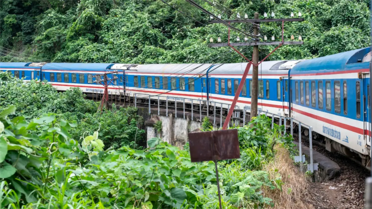
Seat classes, booking tips and the best trains are covered in our Vietnam train guide. You can check the timetables on the official Vietnam Railways website.
Boat and Ferry Crossings
| Crossing | Time | Notes |
|---|---|---|
| Tuan Chau (Ha Long) – Gia Luan (Cat Ba) | about 45 min–1 h | Car ferry; Cat Ba Town is about 30 min further by road |
| Hai Phong (Binh port) – Cat Ba Town | about 45 min | Fast boat |
| Got pier (Hai Phong) – Cai Vieng (Cat Ba) | 15–20 min | Car ferry used by Hanoi – Cat Ba combo buses |
| Rach Gia – Phu Quoc (Bai Vong) | about 2.5 h | Fast ferry |
| Ha Tien – Phu Quoc (Bai Vong) | about 1.5 h by fast ferry; 2.5–3 h by car ferry | Shortest sea crossing to Phu Quoc |
| Cua Dai (Hoi An) – Cham Islands | about 15–30 min | Speedboat; trips run mainly March–August |
| Chau Doc – Phnom Penh (Cambodia) | about 5 h | Speedboat up the Mekong, including the border |

Boats sail only when the port authority allows departures. In the windy season some crossings are cancelled at short notice, so leave a spare half-day before onward flights. Read more about the Cham Islands, Lan Ha Bay and Chau Doc.
Road Distance Matrix: Northern and Central Vietnam
Road distances in km between the main hubs, rounded to the nearest 5 km. Read across a row and down a column to find any pair.
| km | Hanoi | Ninh Binh | Ha Long | Sa Pa | Ha Giang | Phong Nha | Hue | Da Nang | Hoi An |
|---|---|---|---|---|---|---|---|---|---|
| Hanoi | – | 100 | 150 | 315 | 285 | 480 | 670 | 770 | 795 |
| Ninh Binh | 100 | – | 175 | 410 | 385 | 385 | 575 | 675 | 700 |
| Ha Long | 150 | 175 | – | 460 | 430 | 555 | 745 | 845 | 870 |
| Sa Pa | 315 | 410 | 460 | – | 230 | 790 | 975 | 1,080 | 1,100 |
| Ha Giang | 285 | 385 | 430 | 230 | – | 775 | 960 | 1,065 | 1,085 |
| Phong Nha | 480 | 385 | 555 | 790 | 775 | – | 210 | 315 | 340 |
| Hue | 670 | 575 | 745 | 975 | 960 | 210 | – | 95 | 120 |
| Da Nang | 770 | 675 | 845 | 1,080 | 1,065 | 315 | 95 | – | 30 |
| Hoi An | 795 | 700 | 870 | 1,100 | 1,085 | 340 | 120 | 30 | – |
Road Distance Matrix: Central and Southern Vietnam
| km | Hoi An | Quy Nhon | Nha Trang | Da Lat | Mui Ne | HCMC | Can Tho | Chau Doc |
|---|---|---|---|---|---|---|---|---|
| Hoi An | – | 290 | 485 | 610 | 700 | 850 | 1,010 | 1,060 |
| Quy Nhon | 290 | – | 215 | 340 | 430 | 620 | 785 | 855 |
| Nha Trang | 485 | 215 | – | 135 | 225 | 415 | 580 | 650 |
| Da Lat | 610 | 340 | 135 | – | 150 | 295 | 460 | 525 |
| Mui Ne | 700 | 430 | 225 | 150 | – | 190 | 355 | 425 |
| HCMC | 850 | 620 | 415 | 295 | 190 | – | 170 | 235 |
| Can Tho | 1,010 | 785 | 580 | 460 | 355 | 170 | – | 120 |
| Chau Doc | 1,060 | 855 | 650 | 525 | 425 | 235 | 120 | – |
HCMC = Ho Chi Minh City (District 1). These are shortest road routes using the expressways open in 2026. The older Highway 1 route can be 50–150 km longer on long legs.
How Much Travel Time to Plan Each Day
- Up to 2 hours on the road: you still have most of the day for sightseeing. Examples: Hanoi – Ninh Binh, Hue – Da Nang, Ho Chi Minh City – Mekong Delta.
- 3–4 hours: a half-day transfer. Add one or two stops on the way, such as the Hai Van Pass, a pottery village or a fruit orchard.
- 5–6 hours: a full travel day. Typical examples are Hanoi – Sa Pa and Hanoi – Ha Giang. Start early to arrive for sunset.
- Over 6 hours or over about 600 km: fly, or take an overnight train or sleeper bus so you do not lose a daylight day.
As a guide, a 2-week north-to-south trip has about 4 transfer days if you fly the long legs, and 6–7 if you go overland the whole way. Our 15-day north-to-south tour uses 2 flights and short road legs. You spend more time at the sights and less in transit.
Local Expert Tips from Jimmy
- Do not trust a “1-hour flight” for planning. Count 4–5 hours door to door. For Hue – Da Nang – Hoi An the road is always faster than flying.
- Sa Pa and Ha Giang are 5–6 hours each way. Do not try them as day trips from Hanoi. Plan at least 2 nights in Sa Pa and 3–4 days for the Ha Giang Loop.
- Combine Ninh Binh and Ha Long without going back to Hanoi. The 170 km transfer takes about 2.5–3 hours and saves half a day.
- Ha Long is a morning drive. Most cruises board around noon, so leave Hanoi by 8:00–8:30. On the way back, do not book a flight earlier than about 17:00 from Noi Bai.
- Ho Chi Minh City traffic is the wild card. Leaving District 1 can take 45–60 minutes at rush hour (7:00–9:00 and 16:30–19:00). Start Mekong and Cu Chi trips early.
- Around Tet (Lunar New Year), roads, buses and trains are packed. Book transport early and allow extra time. Tet falls on 6 February 2027.
- Rainy season changes the maths on mountain roads. In central Vietnam from October to November, and in the far north in summer, landslides can close passes for hours. Keep a buffer day before international flights.
Planning a route? Tell us your dates and pace and we will design the transfers for you, with private cars, train tickets and flights in one plan. Contact Vietnam Tour Expert Team or read our guide to getting around Vietnam.
Frequently Asked Questions about Distances in Vietnam
1. How far is Ninh Binh from Hanoi?
Ninh Binh (Tam Coc and Trang An) is about 90–100 km south of Hanoi. It takes about 1.5–2 hours by private car or limousine van, or about 2 hours 15 minutes by train, so it is an easy day trip.
2. How long does it take from Hanoi to Ha Long Bay?
Hanoi to Ha Long Bay (Bai Chay or Tuan Chau harbour) is about 150–170 km and takes about 2.5–3 hours on the expressway. Most cruises include a shuttle bus from the Old Quarter. There is no train to Ha Long Bay.
3. How far is Sa Pa from Hanoi and what is the best way to get there?
Sa Pa is about 315–320 km from Hanoi. A private car takes about 5–5.5 hours, and a sleeper or limousine bus takes 5.5–6.5 hours. The overnight train to Lao Cai takes about 8 hours, followed by about 50 minutes by road to Sa Pa.
4. How long is the drive from Hanoi to Ha Giang?
Hanoi to Ha Giang City is about 285–300 km: 5.5–6.5 hours by car or 6.5–8 hours by sleeper bus. The full Ha Giang Loop beyond the city is about 350 km and is best done over 3–4 days.
5. What is the distance from Hanoi to Ho Chi Minh City?
Hanoi to Ho Chi Minh City is about 1,500–1,700 km by road, depending on the route, and 1,726 km by rail. A non-stop flight takes about 2 hours 10 minutes, and the fastest train takes 32.5–35 hours.
6. How long is the flight from Hanoi to Da Nang?
A non-stop flight from Hanoi to Da Nang takes about 1 hour 20–1 hour 25 minutes. Da Nang airport is only 3–5 km from the city centre and about 30 km (40–45 minutes) from Hoi An.
7. How far is Hoi An from Da Nang?
Hoi An is about 30 km from central Da Nang and from Da Nang airport. The drive takes about 40–50 minutes by car, Grab or shuttle bus. Hoi An has no airport or railway station.
8. How long does it take from Hue to Hoi An?
Hue to Hoi An is about 120–130 km. It takes 2.5–3 hours through the Hai Van Tunnel, or 3.5–4.5 hours over the scenic Hai Van Pass with stops at Lang Co and the summit. There is no direct train to Hoi An.
9. How far is Phong Nha from Hanoi and Hue?
Phong Nha is about 470–485 km from Hanoi (7–8 hours by car) and about 210 km from Hue (3.5–4 hours). Most travellers fly or take the train from Hanoi to Dong Hoi, which takes about 1 hour by air or 9.5–10.5 hours by train. From Dong Hoi it is 40–45 km (45 minutes–1 hour) by road to Phong Nha.
10. How far is the Mekong Delta from Ho Chi Minh City?
My Tho is about 70 km (1.5–2 hours) from Ho Chi Minh City, Ben Tre about 85 km (2–2.5 hours) and Can Tho about 170 km (3.5–4 hours). Chau Doc, near the Cambodian border, is about 235–250 km (5–6 hours).
11. How long does it take from Ho Chi Minh City to Da Lat?
Ho Chi Minh City to Da Lat is about 300 km by road and takes 6–8 hours via the mountain passes. A flight to Lien Khuong airport takes 50 minutes–1 hour, plus 40–50 minutes into Da Lat.
12. How far is Mui Ne from Ho Chi Minh City?
Mui Ne is about 190–200 km from Ho Chi Minh City. It takes about 3–3.5 hours by car on the new expressway. The train to Binh Thuan station takes about 3.5–4 hours, followed by about 40 minutes by road.
13. How long is the train from Hanoi to Ho Chi Minh City?
The fastest Reunification Express trains take about 32.5–35 hours to cover the 1,726 km between Hanoi and Ho Chi Minh City. Slower trains take up to about 40 hours. Most travellers break the journey at Ninh Binh, Hue, Da Nang or Nha Trang.
14. How do you get to Phu Quoc and how long does it take?
Fly from Ho Chi Minh City (about 1 hour) or Hanoi (about 2 hours 10–2 hours 20 minutes). By sea, the fast ferry from Rach Gia takes about 2.5 hours and from Ha Tien about 1.5 hours. Ho Chi Minh City to Rach Gia is about 5–6 hours by road.
15. Can I travel from Ninh Binh to Ha Long Bay without going back to Hanoi?
Yes. Ninh Binh to Ha Long Bay is about 170–175 km and takes about 2.5–3 hours by car or shuttle bus. Going direct saves about half a day compared with returning to Hanoi.
16. Is it better to fly or take the train in Vietnam?
Fly any leg over about 600 km, such as Hanoi – Da Nang or Da Nang – Ho Chi Minh City, when time is short. Take the train for the scenic Hue – Da Nang coast, or overnight to Lao Cai (Sa Pa) and Dong Hoi (Phong Nha). For trips under about 250 km, a private car is usually fastest door to door.
17. How many hours a day should I plan to travel in Vietnam?
Plan no more than 4–5 hours on the road per day. Up to 2 hours still leaves most of the day for sightseeing. For anything over about 6 hours, fly or take an overnight train or sleeper bus.
18. How long is Vietnam from north to south?
Vietnam is about 1,650 km long from north to south and only about 50 km wide at its narrowest point, near Dong Hoi. Hanoi and Ho Chi Minh City are 1,726 km apart by rail.
Related Posts

Vietnam Train Guide 2026: Reunification Express Routes, Times & Fares

Getting Around Vietnam 2026: Flights, Trains, Buses, Grab & Transfers
Da Nang to Nha Trang 2026: Train, Bus, Flight & Car Guide

Hanoi to Cat Ba & Lan Ha Bay 2026: Bus, Ferry & Car Guide

Ho Chi Minh City to Da Nang 2026: Flight, Train & Bus Guide